|
|
Lake Superior--Its shores and character--Geology--Brigade of
boats--Dog and porcupine--Burrowing birds--Otter--Keweena
Point--Unfledged ducks--Minerals--Canadian resource in a tempest of
rain--Tramp in search of the picturesque--Search for native
copper--Isle Royal descried--Indian precaution--Their
ingenuity--Lake action--Nebungunowin River--Eagles--Indian tomb--Kaug
Wudju.
1831. LAKE SUPERIOR lay before us. He who, for the first time,
lifts his eyes upon this expanse, is amazed and delighted at its
magnitude. Vastness is the term by which it is, more than any other,
described. Clouds robed in sunshine, hanging in fleecy or nebular
masses above--a bright, pure illimitable plain of water--blue
mountains, or dim islands in the distance--a shore of green foliage
on the one hand--a waste of waters on the other. These are the
prominent objects on which the eye rests. We are diverted by the
flight of birds, as on the ocean. A tiny sail in the distance
reveals the locality of an Indian canoe. Sometimes there is a smoke
on the shore. Sometimes an Indian trader returns with the avails of
his winter's traffic. A gathering storm or threatening wind arises.
All at once the voyageurs burst out into one of their simple
and melodious boat-songs, and the gazing at vastness is relieved and
sympathy at once awakened in gayety. Such are the scenes that attend
the navigation of this mighty but solitary body of water. That
nature has created such a scene of magnificence merely to look at,
is contrary to her usual economy. The sources of a busy future
commerce lie concealed, and but half concealed, in its rocks. Its
depths abound in fish, which will be eagerly sought, and even its
forests are not without timber to swell the objects of a future
commerce. If the plough is destined to add but little to its wealth,
it must be recollected that the labors of the plough are most
valuable where the area suitable for its dominion is the smallest.
But even the prairies of the West are destined to waft their
superabundance here.
We passed the lengthened shores which give outline to Taquimenon
Bay. We turned the long and bleak peninsula of White Fish Point, and
went on to the sandy margin of Vermilion Bay. Here we encamped at
three o'clock in the afternoon, and waited all the next day for the
arrival of Lieut. Robert Clary and his detachment of men, from Fort
Brady, who were to form a part of the expedition. With him was
expected a canoe, under the charge of James L. Schoolcraft, with
some supplies left behind, and an express mail. They both arrived
near evening on the 28th, and thus the whole expedition was formed
and completed, and we were prepared to set out with the latest mail.
Mr. Holliday came in from his wintering grounds about the same time,
and we left Vermilion Bay at four o'clock on the morning of the
29th, J.L.S. in his light canoe, and chanting Canadians for Sault
St. Marie, and we for the theatre of our destination.
We went about forty miles along a shore exclusively sandy, and
encamped at five o'clock in the evening at Grand Marais. This is a
striking inlet in the coast, which has much enlarged itself within
late years, owing to the force of the north-west storms. It exhibits
a striking proof of lake action. The next day we passed the naked
and high dunes called Grand Sable, and the storm-beaten and
impressive horizontal coat of the Pictured Rocks, and encamped at
Grand Island, a distance of about 130 miles. I found masses of
gypsum and small veins of calcareous spar imbedded in the sandstone
rock of the point of Grand Sable. Ironsand exists in consolidated
layers at the cliff called Doric Rock.
The men and boats were now in good traveling trim, and we went on
finely but leisurely, examining such features in the natural history
as Dr. Houghton, who had not been here before, was anxious to
see. On the 1st of July, we encamped at Dead River, from whence I
sent forward a canoe with a message, and wampum, and tobacco, to
Gitchee Iauba, the head chief of Ancekewywenon, requesting him to
send a canoe and four men to supply the place of an equal number
from the Sault St. Marie, sent back, and to accompany me in my
voyage as far as La Pointe.
GEOLOGY.--We spent the next day in examining the magnesian and
calcareous rubblestone which appears to constitute strata resting
against and upon the serpentine rock of Presque Isle. This rock is
highly charged with what appears to be chromate of iron. We examined
the bay behind this peninsula, which appears to be a harbor capable
of admitting large vessels. We ascended a conical hill rising from
the bay, which the Indians call Totoesh, or Breast Mountain.
Having been the first to ascend its apex, the party named it
Schoolcraft's Mountain. Near and west of it, is a lower
saddle-shaped mountain, called by the natives The Cradle Top.
Granite Point exhibits trap dykes in syenite. The horizontal red
sandstone, which forms the peninsula connecting this point with the
main, rests against and upon portions of the granite, showing its
subsidence from water at a period subsequent to the upheaval of the
syenite and trap. This entire coast, reaching from Chocolate River
to Huron Bay--a distance of some seventy miles--consists of granite
hills, which, viewed from the top of the Totoesh, has the rolling
appearance of the sea in violent motion. Its chief value must result
from its minerals, of which iron appears to constitute an important
item.
We reached Huron River on the 4th of July about three o'clock in the
afternoon, having come on with a fine wind. At this place we met Mr.
Aitkin's brigade of boats, seven in number, with the year's hunts of
the Fond du Lac department. I landed and wrote official notes to the
Sault St. Marie and to Washington, acquainting the government with
my progress, and giving intelligence of the state of the Indians.
TRADERS' BOATS.--Mr. Aitkin reports that a great number of the
Indians died of starvation, at his distant posts, during the winter,
owing to the failure of the wild rice. That he collected for his own
use but eight bushels, instead of about as many hundreds. That he
had visited Gov. Simpson at Pembina, and found the latter unwilling
to make any arrangements on the subject of discontinuing the sale of
whisky to the Indians. That I was expected by the Indians on the
Upper Mississippi, in consequence of the messages sent in, last
fall. That efforts continue to be made by the agent at St. Peters,
to draw the Chippewas to that post, notwithstanding the bloodshed
and evils resulting from such visits. That a hard opposition in
trade has been manifested by the Hudson's Bay Company. That they
have given out medals to strengthen and increase their influence
with our Indians. And that liquor is required to oppose them at
Pembina, War Road, Rainy Lake, Vermilion Lake and Grand Portage.
DOG AND PORCUPINE.--While at Huron River, we saw a lost dog left
ashore, who had been goaded by hunger to attack a porcupine. The
quills of the latter were stuck thickly into the sides of the nose
and head of the dog. Inflammation had taken place, rendering the
poor beast an object of pity and disgust.
BURROWING BIRDS.--At Point Aux Beignes (Pancake Point) one of the
men caught a kingfisher by clapping his hand over an orifice in the
bank. He also took from its nest six eggs. The bank was perforated
by numbers of these orifices. At this point we observed the
provisions of our advance camp, put in cache, to lighten it
for the trip down the bay. Leaving Mr. G. Johnston and Mr.
Melancthon Woolsey at this point to await the return of the canoe, I
proceeded to Cascade, or, as it is generally called, Little Montreal
River. Johnston and Woolsey came up during the night. Next morning
an Indian came from a lodge, leading a young otter by a string. The
animal played about gracefully, but we had no temptation to purchase
him with our faces set to the wilderness. At the latter place, which
is on a part of the Sandy-bay of Graybeast River, the trap
formation, which is the copper-bearing rock, is first seen. This
rock, which forms the great peninsula of Kewywenon, rises into
cliffs on this bay, which at the elevation called Mammels by the
French, deserve the name of mountains. Portions of this rock, viewed
in extenso, are overlaid by amygdaloid and rubblestone--the latter
of which forms a remarkable edging to the formation, in some places,
on the north-west shore, that makes a canal, as at the Little
Marrias.
KEWEENA PENINSULA.--We were six days in coasting around this
peninsula, which is highly metalliferous. At some points we employed
the blast, to ascertain the true character and contents of the soil.
At others we went inland, and devoted the time in exploring its
range and extent. We examined the outstanding isolated vein of
carbonate of copper, called Roche Vert by the French. In
seeking for its connection on the main shore, I discovered the black
oxide in the same vein. In the range of the greenstone about two
leagues south of this point, a vein of native copper, with ores and
veinstones, was observed, and specimens taken.
The N.W. coast of the peninsula is greatly serrated and broken,
abounding in little bays and inlets, and giving proofs of the
terrible action of the storms on this rugged shore.
Notes of these examinations and of a trip inland were made, which
cannot here be referred to more particularly.
UNFLEDGED DUCKS.--The men had rare and very exciting sport, in
coasting around the peninsula, in catching the young of the onzig--which
is the sawbill. In the early part of the month of July, the wings of
the young are not sufficiently developed to enable them to fly. They
will run on the water, flapping their unfledged wings, with great
speed, but the gay Frenchmen, shouting at the top of their lungs,
would propel their canoes so as to overtake them whenever the little
fugitives could not find some nook in the rock to hide in. They
chased down one day thirteen in this way, which were found a most
tender and delicate dish. The excitement in these chases was
extreme. At the Grand Marrias (now near Fort Wilkins) we
obtained from the shore of the inner bay, agates, stilbite, and
smoky quartz, &c.
SINGULAR VIVACITY.--In going from this bay through a rock-bound
strait, the rain fell literally in sheets. There was no escape, and
our only philosophy was to sit still and bear it. The shower was so
great that it obscured objects at a short distance. All at once the
men struck up a cheerful boat song, which they continued, paddling
with renewed energy, till the shower abated. I believe no other
people under the sun would have thought of such a resource.
TRAMP IN SEARCH OF THE PICTURESQUE.--The wind rising ahead, we took
shelter in an inlet through the trap range, which we called
Houghton's Cove. After taking a lunch and drying our things, it was
proposed to visit a little lake, said to give origin to the stream
falling into its head. The journey proved a toilsome one; but, after
passing through woods and defiles, we at length stood on a cliff
which overlooked the object sought for--a pond covered with aquatic
plants. Wherever we might have gone in search of the picturesque,
this seemed the last place to find it. On again reaching the lake
the wind was found less fierce, and we went on to Pine River, where
we encamped on coarse, loose gravel.
SEARCH FOR NATIVE COPPER.--The next day the wind blew fiercely, and
we could not travel. In consequence of reports from the Indians of a
large mass of copper inland, I manned a light canoe, and, leaving
the baggage and camp in charge of Lesart, went back to a small bay
called Mushkeeg, and went inland under their guidance. We wandered
many miles, always on the point of making the discovery, but never
making it; and returned with our fatigue for our pains. It was seven
o'clock in the evening before we returned to our camp--at eight the
wind abated, and we embarked, and, after traveling diligently all
night, reached the western terminus of the Keweena portage at two
o'clock next morning--having advanced in this time about twenty-four
miles. Next day, July 10, the wind rose again violently ahead.
ISLE ROYAL DESCRIED.--In coming down the coast of the Keweena
Peninsula, we descried the peaks of this island seen dimly in the
distance, which it is not probable could have been done if the
distance were over sixty miles.
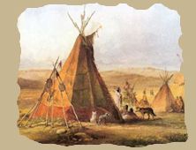
INDIAN PRECAUTION, THEIR INGENUITY.--We found several Chippewa
Indians encamped. They brought a trout, the large lake trout, and
were, as-usual, very friendly. We saw a fresh beaver's skin
stretched on the drying hoop, at the Buffalo's son's lodge. But the
women had secreted themselves and children in the woods, with the
dried skins, supposing that a trader's canoe had landed, as we had
landed in the night. This may give some idea of the demands of trade
that are usually made, and the caution that is observed by them when
a trader lands.
We here saw the claws-of two owls, with the skin and leg feathers
adhering, sewed together so closely and skilfully, by the Indian,
women, as to resemble a nondescript with eight claws. It was only by
a close inspection that we could discover the joinings.
LAKE ACTION.--The geological action of the lake against the high
banks of diluvion, at this spot, is very striking. It has torn away
nearly all the ancient encamping ground, including the Indian
burials. Human bones were found scattered along the declivity of
fallen earth. An entire skull was picked up, with the bark wrappings
of the body, tibia, &c.
At seven in the evening the tempest ceased so as to enable us to
embark. We kept close in shore, as the wind was off land, a common
occurrence on these lakes at night. On turning the point of red
sandstone rock, which the Indians call Pug-ge-do-wau
(Portage), the Porcupine Mountains rose to our view, directly west,
presenting an azure outline of very striking lineaments--an animal
couchant. As night drew on, the water became constantly smoother; it
was nine before daylight could be said to leave us. We passed, in
rapid succession, the Mauzhe-ma-gwoos or Trout, Graverod's,
Unnebish, or Elm, and Pug-ge-do-wa, or Misery River, in
Fishing Bay. Here we overtook Lieut. Clary, and encamped at one
o'clock A.M. (11th). We were on the lake again at five o'clock. We
turned point a la Peche, and stopped at River
Nebau-gum-o-win for breakfast. While thus engaged, the wind rose
and shifted ahead. This confined us to the spot.
NEBAUGUMOWIN RIVER.--Mr. Johnston, Dr. Houghton, and Mr. Woolsey,
made an excursion in a canoe up the river. They went about three or
four miles--found the water deep, and the banks high and dry on the
right side (going up), and covered with maple, ash, birch, &c. At
that distance the stream was obstructed by logs, but the depth of
water continued. Dr. H. added to his botanical collection.
Altogether appearances are represented more favorable than would be
inferred from the sandy and swampy character of the land about its
discharge into the lake.
EAGLES.--While at the Mauzhe-ma-gwoos River, Lieut. Clary
captured a couple of young eagles, by letting his men cut down a
large pine. One of the birds had a wing broken in falling. They were
of the bald-headed kind, to which the Chippewas apply the term
Megizzi, or barker. He also got a young mink from an Indian
called Wabeno. The men also caught some trout in that river,
for which it is remarkable.
At two o'clock the wind had somewhat abated, so as to allow us to
take the lake, and we reached and entered the Ontonagon River at
half past four o'clock. Mr. Johnston with the store canoe, and
Lieut. Clary with his boat, came in successively with colors flying.
Kon-te-ka, the chief, and his band saluted us with several
rounds of musketry from the opposite shore. Afterwards they crossed
to our camp, and the usual exchange of ceremonies and civilities
took place. In a speech from the chief he complained much of hunger,
and presented his band as objects of charitable notice. I explained
to him the pacific object of my journey, and the route to be
pursued, and requested the efficient co-operation of himself and his
band in putting a stop to war parties, referring particularly to
that by Kewaynokwut in 1824, which, although raised against the
Sioux, had murdered Finley and his men at Lake Pepin. This party was
raised on the sources of the Ontonagon and Chippewa. I told him how
impossible it was that his Great Father should ever see their faces
in peace while they countenance or connive at such dastardly war
parties, who went in quest of a foe, and not finding him, fell upon
a friend. He said he had not forgotten this. Even now, I continued,
a chief of the Sauks was trying to enlist the Indians in a scheme of
extreme hostilities. It was a delusion. They had no British allies
to rally on as in former wars. The time was past--past forever for
such plans. We are in profound peace. And their Great Father, the
President, would, if the scheme was pursued by that chief, order his
whole army to crush him. I requested him to inform me of any
messages, or tobacco, or wampum they might receive, on the subject
of that chief's movement, or any other government matter. And to
send no answer to any such message without giving me notice.
At three o'clock on the morning of the next day (12th July), Dr.
Houghton, Mr. Johnston, Lieut. Clary, and Mr. Woolsey, with nine
Canadians and one soldier, set out in my canoe to visit the copper
rock. Konteka sent me a fine carp in the morning. Afterwards he and
the other chief come over to visit me. The chief said that his
child, who had been very ill, was better, and asked me for some
white rice (waube monomin) for it, which I gave. I also
directed a dish of flour and other provisions to enable him to have
a feast.
INDIAN TOMB.--One of the Indians had a son drowned a few days before
our arrival; the grave was neatly picketed in. On the west side of
the river is a grave or tomb above ground, resembling a lodge,
containing the coffin of a chief, who desired to be thus buried, as
he believed his spirit would go directly up.
Konteka has a countenance indicative of sense and benevolence. I
asked him the number of his band. He replied sixty-four men and
boys, women and girls. Sixteen were hunters, of whom thirteen were
men grown.
KAUGWUDJU.--The Porcupine Mountains, which first loomed up after
passing Puggedawa Point, were very plainly pictured before us in the
landscape. I asked Konteka their Indian name. He replied Kaug Wudju.
I asked him why they were so called. He said from a resemblance to a
couching porcupine. I put several questions to him to ascertain the
best place of ascent. He said that the mountain properly faced the
south, in a very high perpendicular cliff, having a lake at its
bottom. The latter was on a level with Lake Superior. To see this
lake it was necessary to go round towards the south. It was a day's
journey from the lake to the top of the cliff. To the first
elevation it was as far as to the Red Rocks--say three miles, but
through a cedar thicket, and bad walking.
VISIT TO THE COPPER ROCK.--The party returned from this place on the
13th, late in the afternoon, bringing specimens of the native
copper. They were nine hours in getting to the forks, and continued
the rest of the day in getting to the rack, where they encamped.
They had been four hours in descending what required nine in going
up. The doctor brought several fine and large masses of the pure
metal.
This site includes some historical
materials that may imply negative stereotypes reflecting the culture or language
of a particular period or place. These items are presented as part of the
historical record and should not be interpreted to mean that the WebMasters in
any way endorse the stereotypes implied.
Personal Memoirs of a Residence of Thirty Years with the
Indian Tribes on the American Frontiers, 1851
Thirty
Years with the Indians
|